Project Highlights | |
|---|---|
| Location | Northern Saskatchewan, Canada |
| Ownership | 100% |
| Status | Early-stage Athabasca Basin exploration project with potential for both high-grade, basement-hosted uranium deposits and REE deposits. Available for option. |
| Commodity | Uranium, REE |
The Spruce Uranium Project
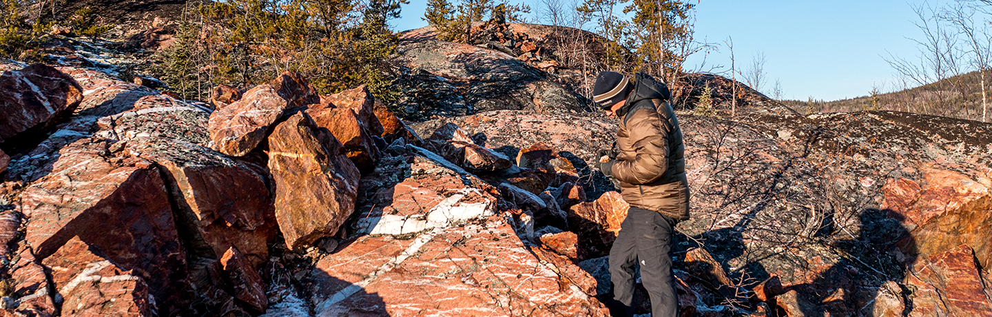
The Project is situated within the north-central margin of the Athabasca Basin and comprises four mineral claims covering 6,855 hectares (Figure 1). The Project covers over six kilometres of prospective strike along the Grease River Shear Zone (“GRSZ”), a crustal-scale structural corridor up to seven kilometres wide. Unlike other major structural zones in the Athabasca Basin, that have yielded the large high-grade uranium discoveries, the GRSZ has seen very limited exploration to date. Historical exploration has demonstrated the GRSZ to be prospective for basement-hosted uranium mineralization, evidenced by the Fond du Lac uranium deposit and numerous historical uranium occurrences (Table 1). In addition, the Project includes anomalous lake sediment samples with up to 287 ppm uranium from historical regional datasets, and several airborne radiometric uranium anomalies. Only three historical drill holes have been completed on the Project to date.
Furthermore, the Project has potential for REE deposits. The northern region of Saskatchewan has a precedent for high REE grades, exemplified by the Alces Lake, Hoidas Lake and Bear Lake REE projects. Historical REE discoveries on the Project were made while prospecting for uranium and records indicate that these occurrences, including outcrop samples of 3.13% TREE, 1.17% TREE, 0.88% TREE and 0.85% TREE, have not been followed-up.
Table 1: Highlight Historical Uranium Occurrences.
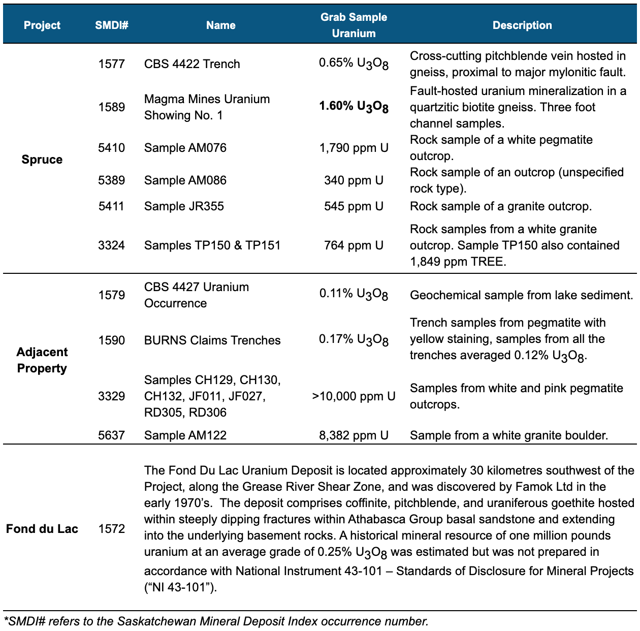
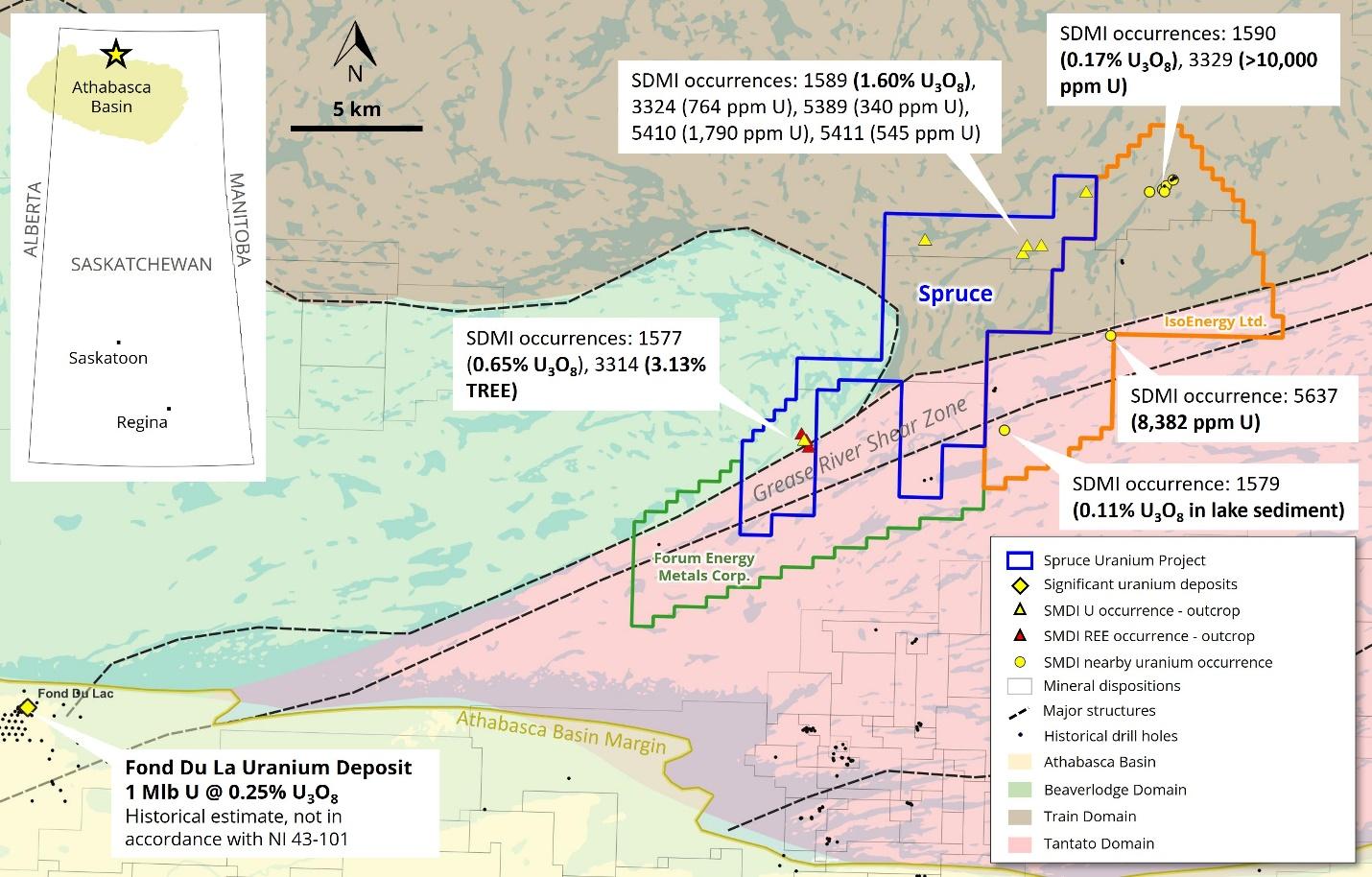
Figure 1: Spruce Uranium Project.
Next Steps
The Project warrants a modern, systematic approach to evaluate the GRSZ and other historical uranium and REE occurrences of interest.
Next steps are planned to include:
- Desk-top Prioritization of Target Areas: Existing historical data (geochemical and airborne geophysical surveys), regional government data, and satellite imagery provide valuable information to commence prioritization of target areas, which would include the identification of favorable lithological and structural settings.
- Field Data Verification and Investigation: Verification of historical datasets is planned within prioritized target areas, to include ground-truthing of uranium and REE occurrences. Scope of work to include geological mapping, scintillometer surveying and grab sampling.
- Drill Target Definition: Drill targets are expected to be defined through geophysical surveying including gravity and magnetics and/or additional EM surveys, as applicable. Geochemical surveys may be warranted based on assessments of suitable sample media.
The Company plans to commence the desk-top prioritization of target areas over the coming weeks. Fortune Bay intends on finding a suitable partner to advance the Project through an earn-in, or similar agreement, that provides Fortune Bay with upside in future discovery.
Technical Disclosure
The historical results contained within this webpage have not been verified and there is a risk that any future confirmation work and exploration may produce results that substantially differ from the historical results. The Company considers these historical results relevant to assess the mineralization and economic potential of the property. The Company also cautions that historical results on adjacent properties are not necessarily indicative of the results that may be achieved on the Project. Further details regarding the historical occurrences noted here can be found within the Saskatchewan Mineral Deposit Index (“SMDI”) using the reference numbers provided in Table 1. Historical assay and scintillometer survey results were captured from assessment reports available in the Saskatchewan Mineral Assessment Database (SMAD) references 74O07-0002, 74O07-0031, 74O09-0023 and 74O09-0024. Historical anomalous lake sediment samples referenced derive from Geological Society of Canada datasets available from the Saskatchewan online GeoAtlas and from assessment report 74O09-0023. Details regarding the Fond du Lac Uranium Deposit can be found in the publication by Homeniuk, L A, Clark, R. J., and Bonnar, R., Eldorado Nuclear Limited, CIM Bulletin May,1982. “Fond-du-Lac uranium deposit”.
Qualified Person
The technical and scientific information on this webpage has been reviewed and approved by Gareth Garlick, P.Geo., Technical Director of the Company, who is a Qualified Person as defined by NI 43-101. Mr. Garlick is an employee of Fortune Bay and is not independent of the Company under NI 43-101.
Cautionary Statements
Information set forth on this webpage may contain forward-looking statements that are based on assumptions as of the date of posting. The reader is referred to the cautionary language contained within the respective Project’s News Releases, in addition to this website’s Terms of Use specifically including Forward Looking Statements.